ARHEA lab
Applied archaeometry
This lab is designed to carry out research, investigation, measurements and physicochemical determinations for the characterization of cultural heritage goods. The main goal is the conservation of national cultural heritage on a scientific basis and the development of new methods of patrimonialization of new archaeological finds.
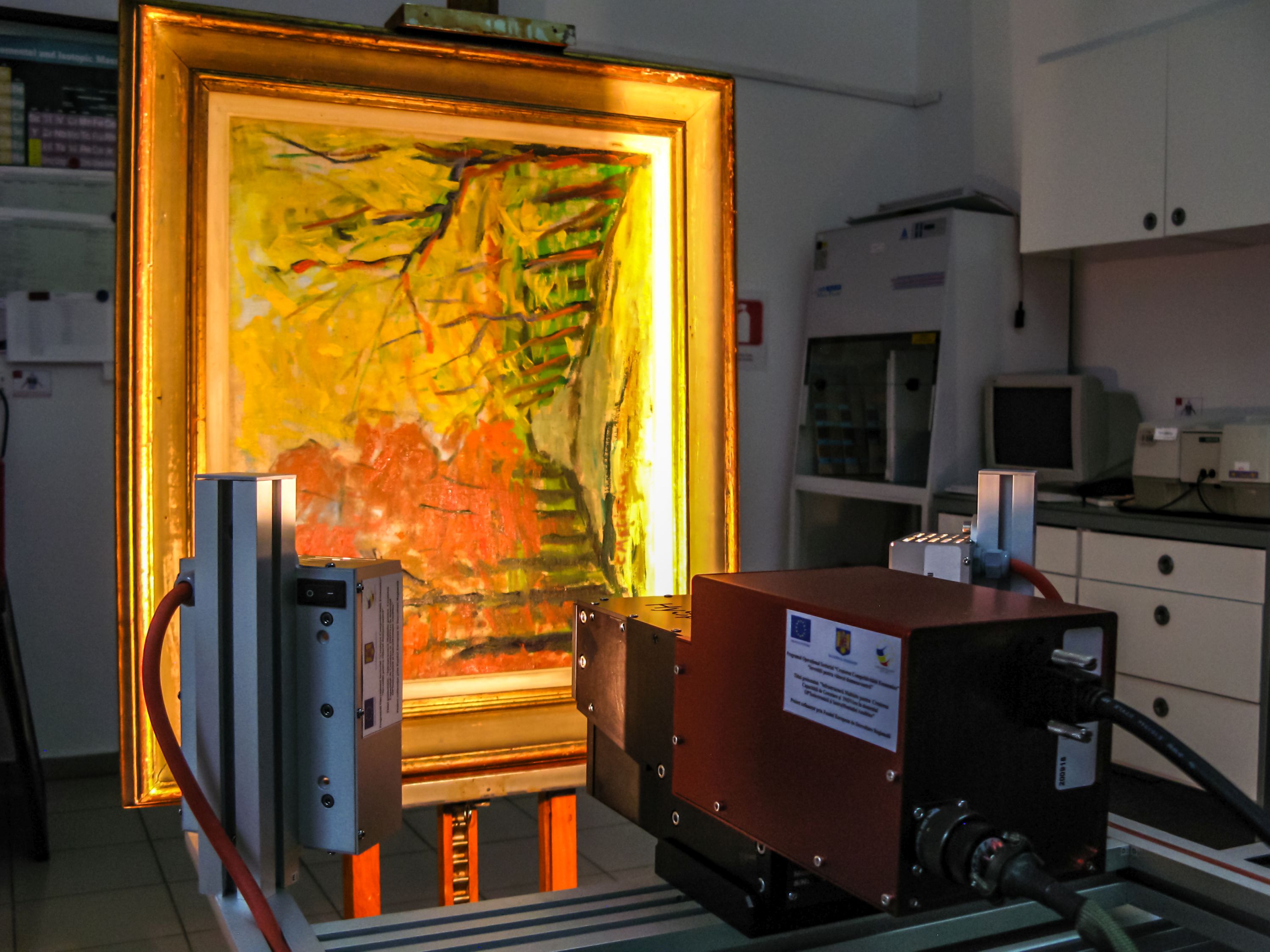
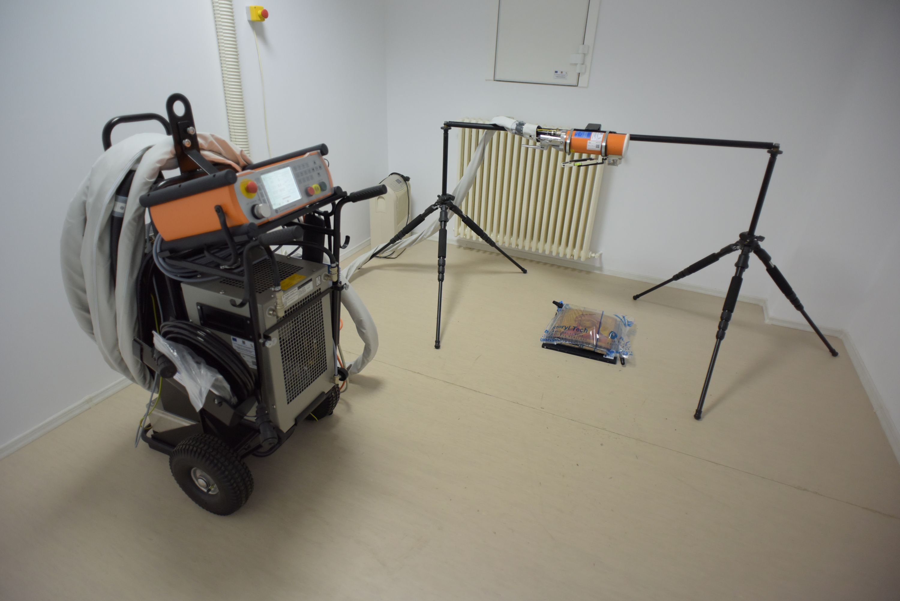
X-RAY imaging
We are using a mobile computerized X-ray imaging system. for non-destructive inspections in the lab but also in situ. This lab is certified and authorized by the C.N.C.A.N. and our team has three level 1 operators and a level 2 expert. With this system, we can investigate a wide range of materials (from canvas paintings to solid iron artifacts) due to its variable working parameters. The irradiation is recorded on digital films that are scanned to a high-resolution digital image.

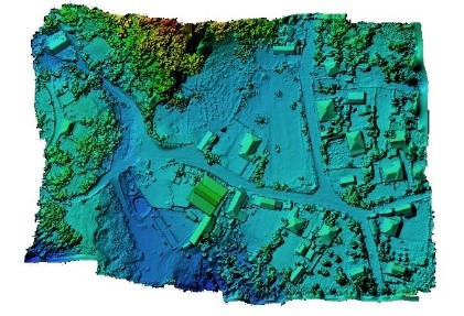
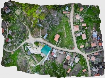
UAV survey
Unmanned air vehicles allow fast surveys on large archaeological areas for scientific data mapping. Our UAV system is equipped with

Hyperspectral imaging
Our SWIR camera is working on 950-2500 nm bandwidth and has a 384 pixel resolution, with each pixel recording up to 288 5 nm spectral bands. Data acquisition uses a push-broom scanning method. We use it in lab or in-situ, being built for harsh environments.